Aerial Imagery Alignment - Dig Hill 80
Aerial imagery shot from a drone of the Dig Hill 80 site was aligned in Agisoft, and orthomosaics were generated. Through the alignment process the images were given geographic coordinates influenced by their matching features between other images and the coordinate data found in their metadata.
The images that failed to automatically align were forced into alignment through markers on shared features between surrounding images. Some images even with hand-placed markers failed to align, leaving a large hole in the bottom right of the orthomosaic.
The orthomosaic was brought into Adobe Photoshop where the images that failed to align were pasted in the area I believed they went. Through this method in Photoshop and the use of the clone stamping tool, I was able to create a believable orthomosaic without any major holes. The orthomosaic was then brought into QGIS to verify its coordinates were accurate. This same process was repeated for the imagery of several other days.
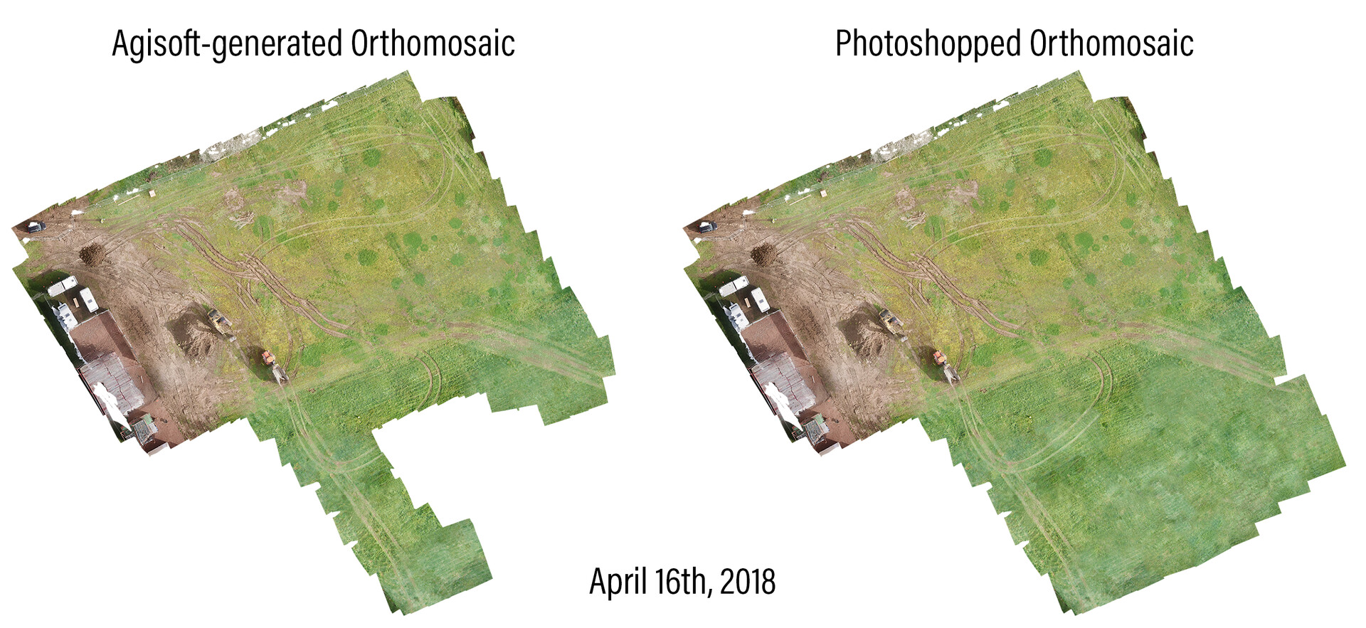
Agisoft-generated orthomosaic vs. the same orthomosaic after filling the major holes in Photoshop

Aerial imagery auto-aligned and hand aligned in Agisoft

Markers were placed on matching features between images to stitch them together

In this case, these three images are oriented based on their 4 shared markers

Dense cloud generated from photogrammetry

DEM generated from the dense cloud